Field delineation
FieldFinder
Precise field boundaries for every field: large and small, regular and irregular, anywhere in the world.
The challenge
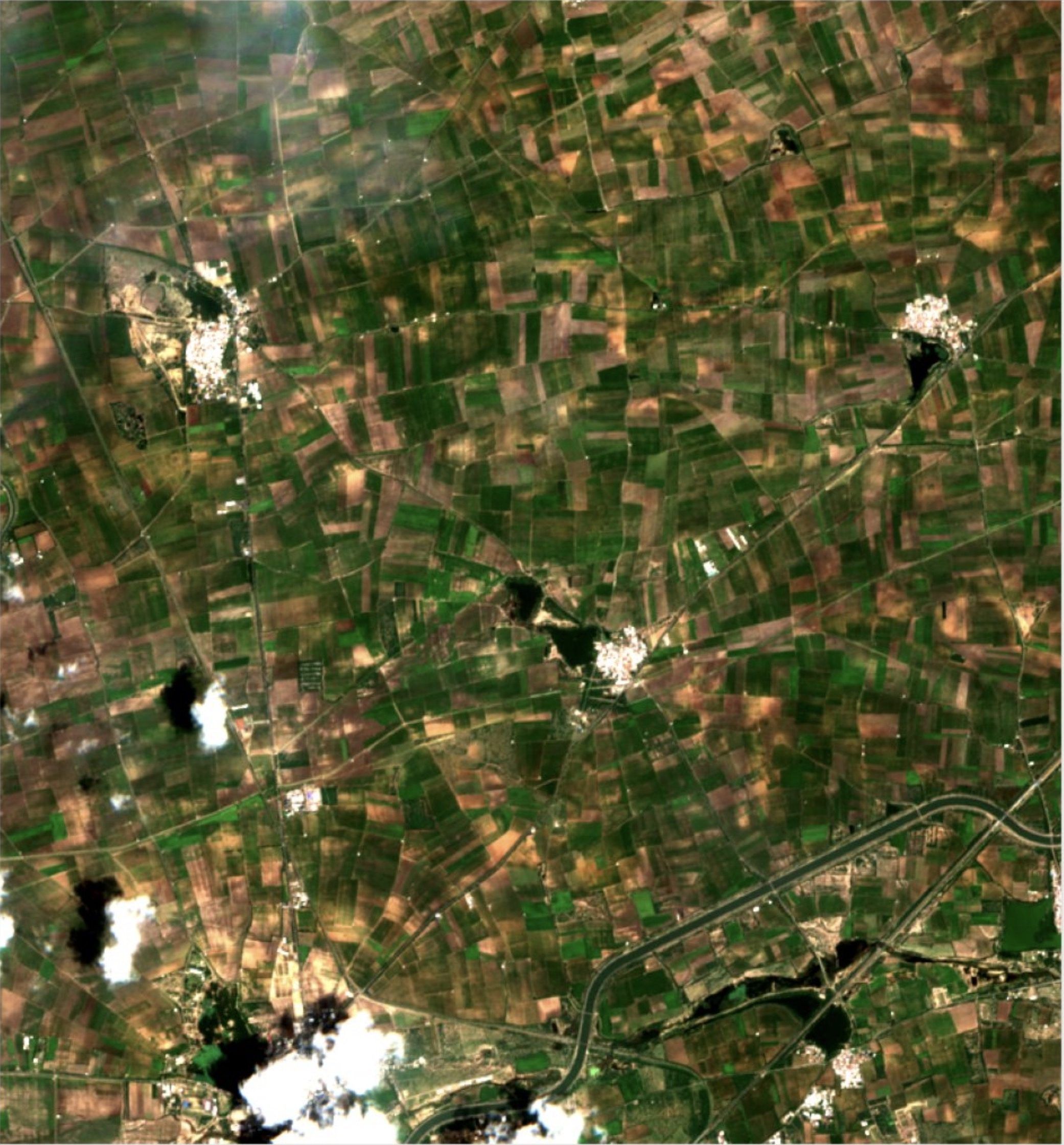
Most field delineation models are trained on large, regular European or North American fields. Applied to small, fragmented and irregular smallholder fields, they merge neighbours, miss boundaries and lose accuracy.
Our approach
FieldFinder extends a proven field boundary model with ground truth from the regions where existing models struggle, among them India, Pakistan, Turkey and Egypt. The result: reliable field delineation anywhere in the world.
A field is not a field.
Field delineation models learn what a field looks like from their training data. Most of it comes from North America and Europe. Apply those models to smallholder regions and they fail, because the fields there break every rule they learned.
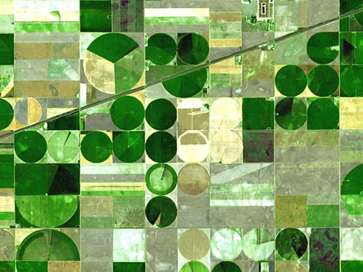
Image: NASA/GSFC/METI/ERSDAC/JAROS, ASTER
Image: Sentinel-2, Marple
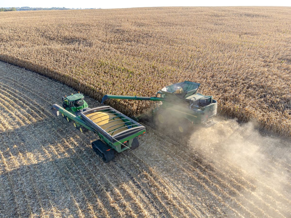
Photo: Wikideas1
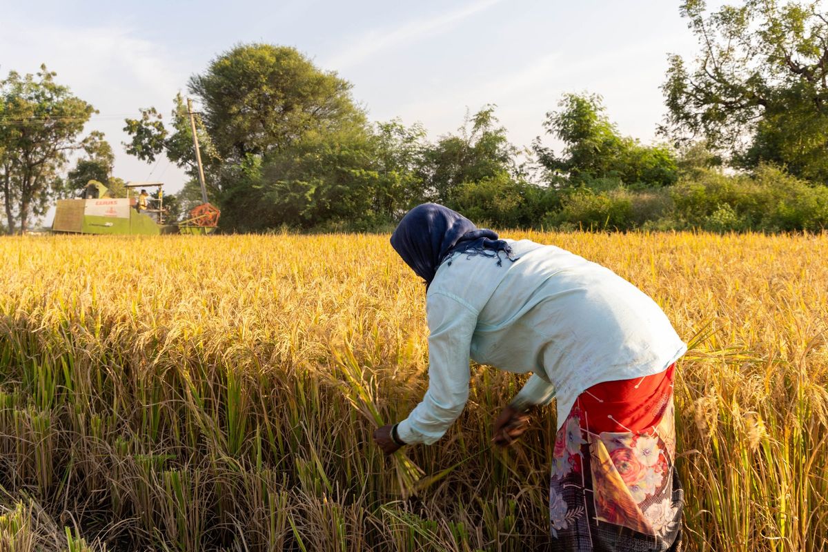
Photo: Nanditha Gogate, WELL Labs
What we did about it.
Instead of using only readily-available field data, we specifically trained FieldFinder on small and irregular fields. Because every result that builds on field boundaries is only as good as the boundaries themselves.
90,000 small fields, annotated at 2.5 m
Our own ground truth from smallholder regions in Asia and Africa. Annotated by hand on super-resolved Sentinel-2 imagery at 2.5 m, with quality checks on every batch.
Flexibility instead of off-the-shelf
Off-the-shelf models are trained once, mostly on European data, and used as they are. We adapt FieldFinder to your region and its field structure.
Extra annotations, at no extra cost
If your region needs more training data, we annotate it as part of the project. Better boundaries for you, a better model for everyone. No surcharge.
The result
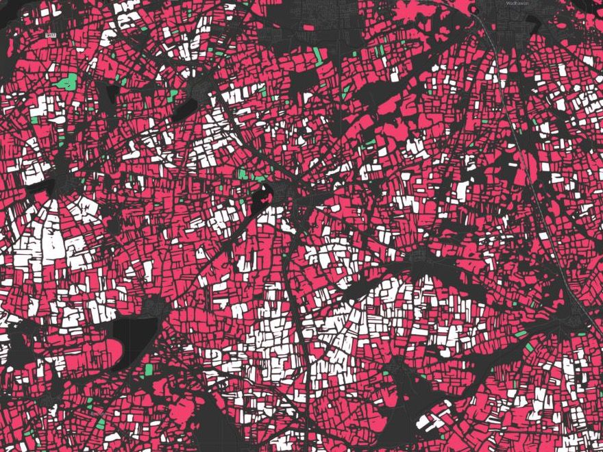
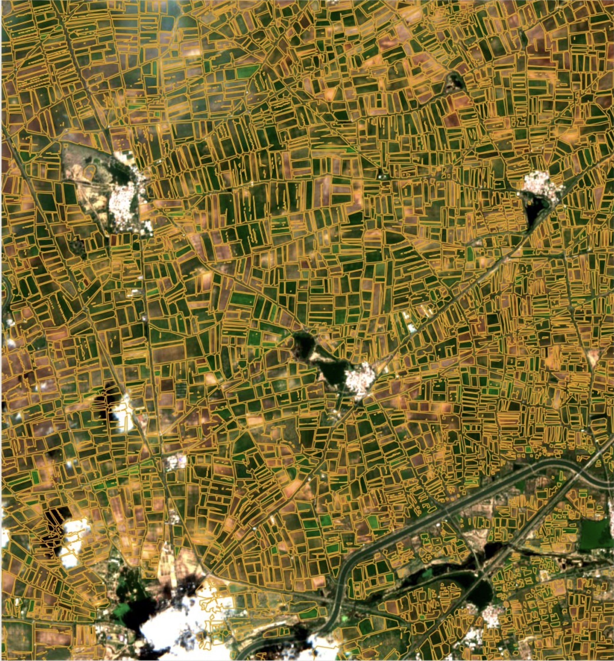
Same area in India, two models. Drag the slider to compare a standard field delineation model with FieldFinder.
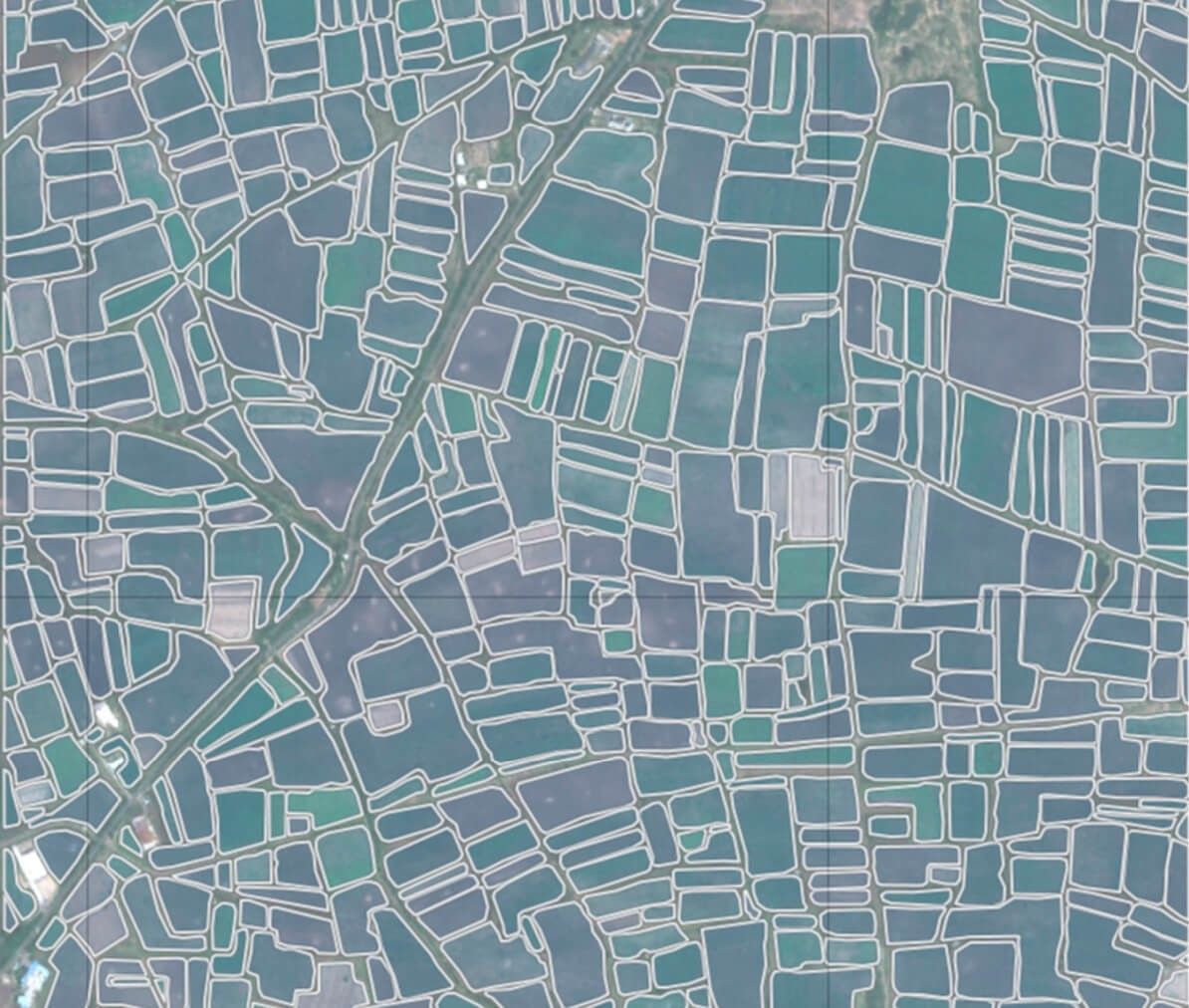
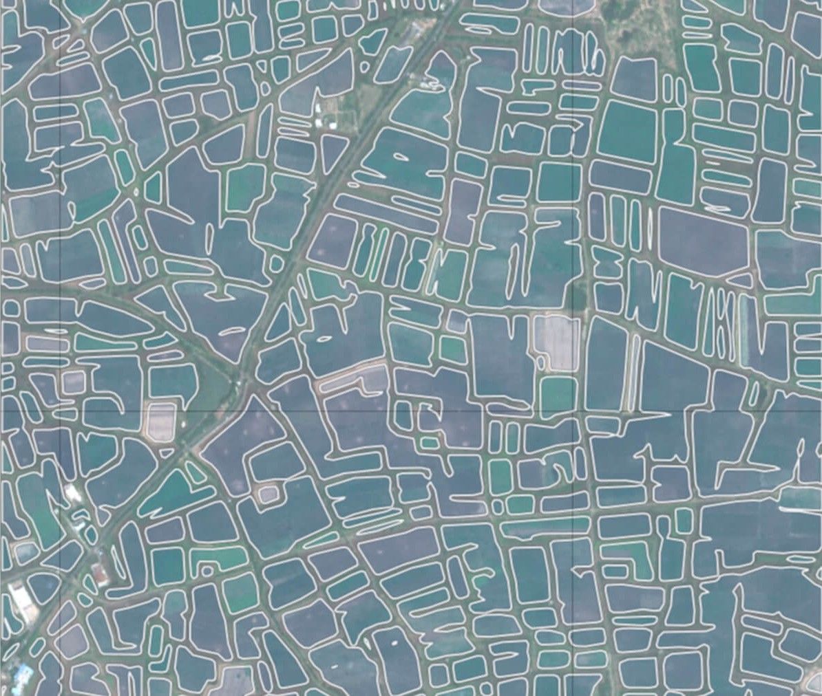
Fewer merged fields. FieldFinder separates neighbouring fields that the standard model merges into one.
Sharper boundaries. Closed, regular field shapes instead of rounded, merged or missing ones.
Where FieldFinder helps
- Supply-chain transparency
- Sustainability certification
- Agricultural monitoring and land-use change
- Policy support and regulatory compliance
Who FieldFinder is for
- Sustainability certification bodies
- Supply-chain transparency platforms
- Agricultural monitoring providers
- Public institutions and climate analytics companies
Developed within the ESA InCubed programme since April 2026. Available as data delivery, API or tailored analytics.
Interested in FieldFinder?
Tell us about your region and your use case, and we’ll show you what FieldFinder can do there.
Daniel Lanz